Southwest USA’s National Parks Display Nature’s Eminence
I’m a lifelong Eastern Seaboard resident, and my open space fix is gazing out at the vast Atlantic Ocean, with its uninterrupted, slightly curved horizon. Except for a few trips to California, I hadn’t enjoyed our country’s big skies “out west” (as we easterners refer to it) for many decades; it was time to explore the Southwest’s national parks. A few years ago, husband Rick and I boarded a September American Airlines flight for a ten-day trip to do just that.
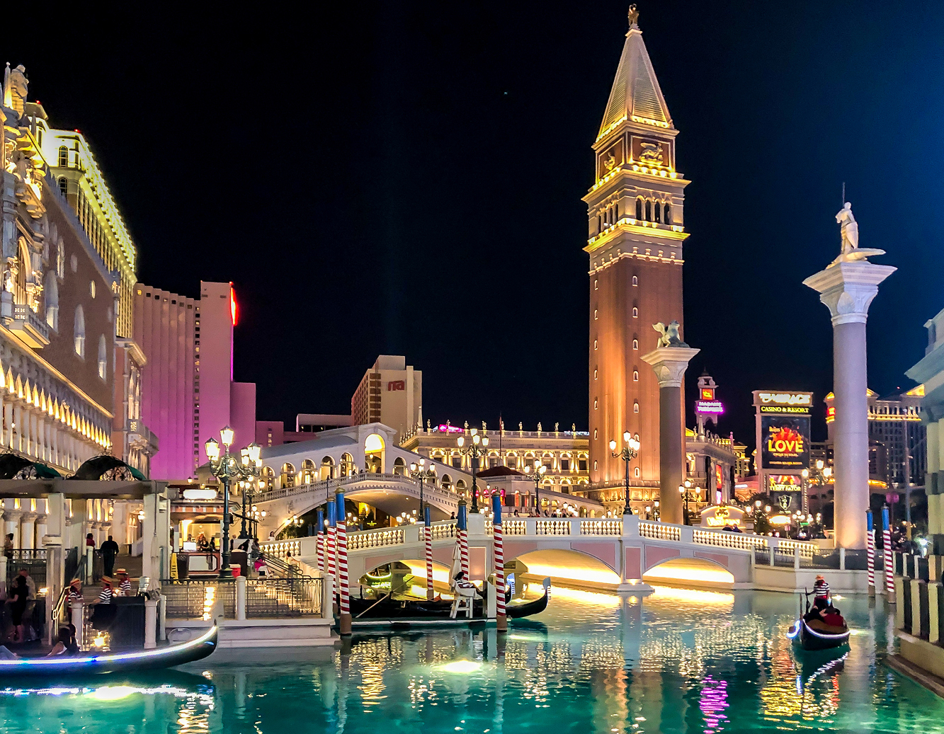
On the way to the parks, we took a detour to Venice…to Las Vegas’ Venetian Hotel and Casino, that is, where glitz and glamour conspire to create an ersatz canal replica. Neither of us gamble. Instead we visited former Philly friends, enjoyed two shows, toured Old Las Vegas (don’t miss the Neon Museum, also known as Neon Boneyard), and previewed our upcoming parks visit with a drive-through of the city’s Red Rock Canyon National Park.
Take a gondola ride on a Venice Canal in Las Vegas
What’s California’s Death Valley all about?
Two hours’ drive west of Las Vegas, Death Valley presents an otherworldly landscape that reminded me of photos I’d seen from the moon landing decades ago. At its lowest depth of 282 feet below sea level and with a 104.5 ° average summer temperature, Death Valley arguably claimed to be the hottest place on Earth, recorded at 134.5 ° in 1913. Global warming recently crushed this century-old record; Iran’s Lut Desert and Mexico’s Sonoran Desert clocked in at 177.4°.
Two superstorms (“atmospheric rivers”) in early 2024 dumped 7.2” in Death Valley, prompting the temporary re-emergence of an ancient lake from tens of thousands of years ago. Dubbed Lake Manly, for a while people kayaked and bathed in this salty body of water, where ordinarily parched salt flats cover Badwater Basin’s floor.
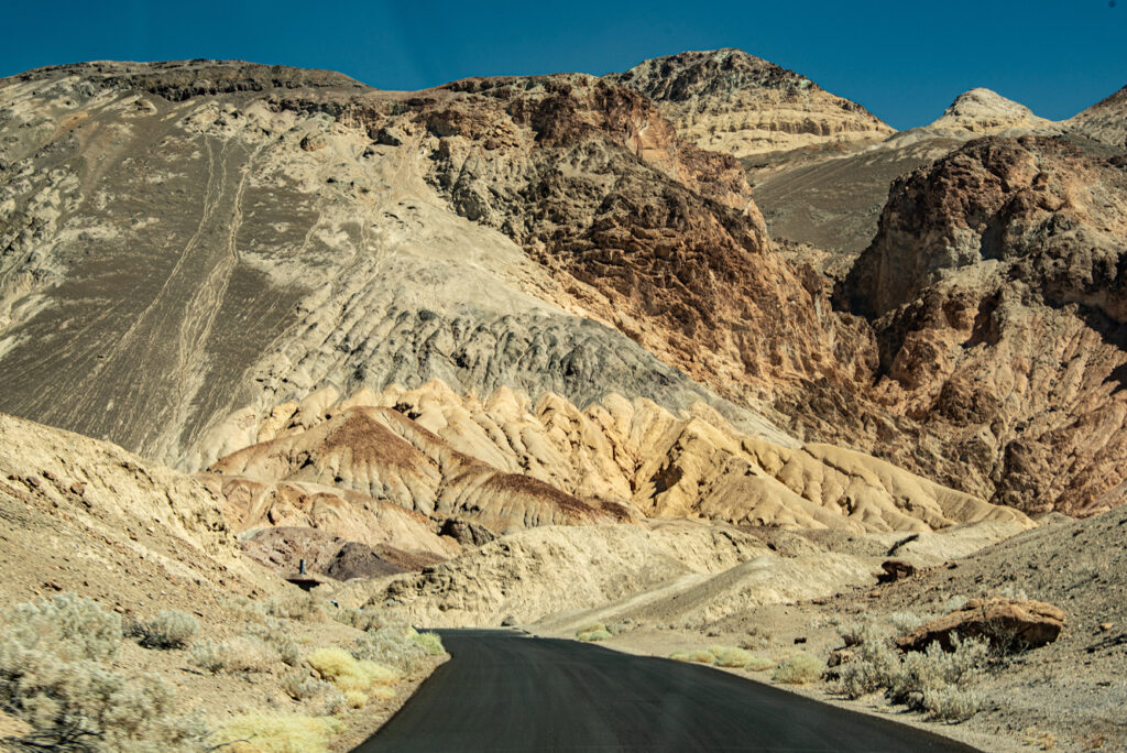
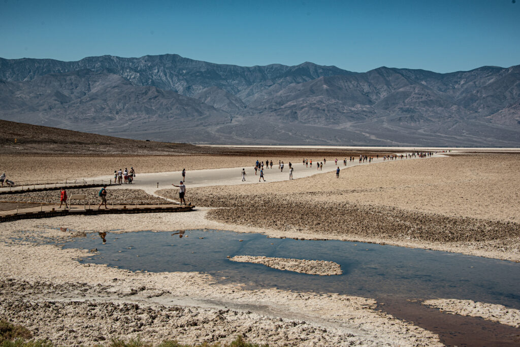
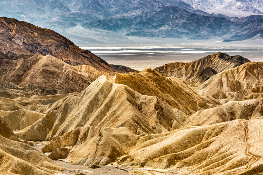
Dry as cow’s bleached bones in the desert, the heat is brutal and unforgiving, though we did stroll onto the salt flats that extend in both directions to distant horizons. Razor edged lava-like rocks form unscalable outcrops. Several elevated lookouts line narrow macadamed one-way Badwater Road. Returning to the Park’s entrance on Artists’ Drive (named for the colorful striated rock formations), we stopped at Zabriski Point for panoramic views of the Park’s spectacular bleakness.
Badwater Road winds among Death Valley’s hills
Boardwalk leads visitors onto Death Valley’s salt flats
Razor-sharp rock formations typify the bleak landscape
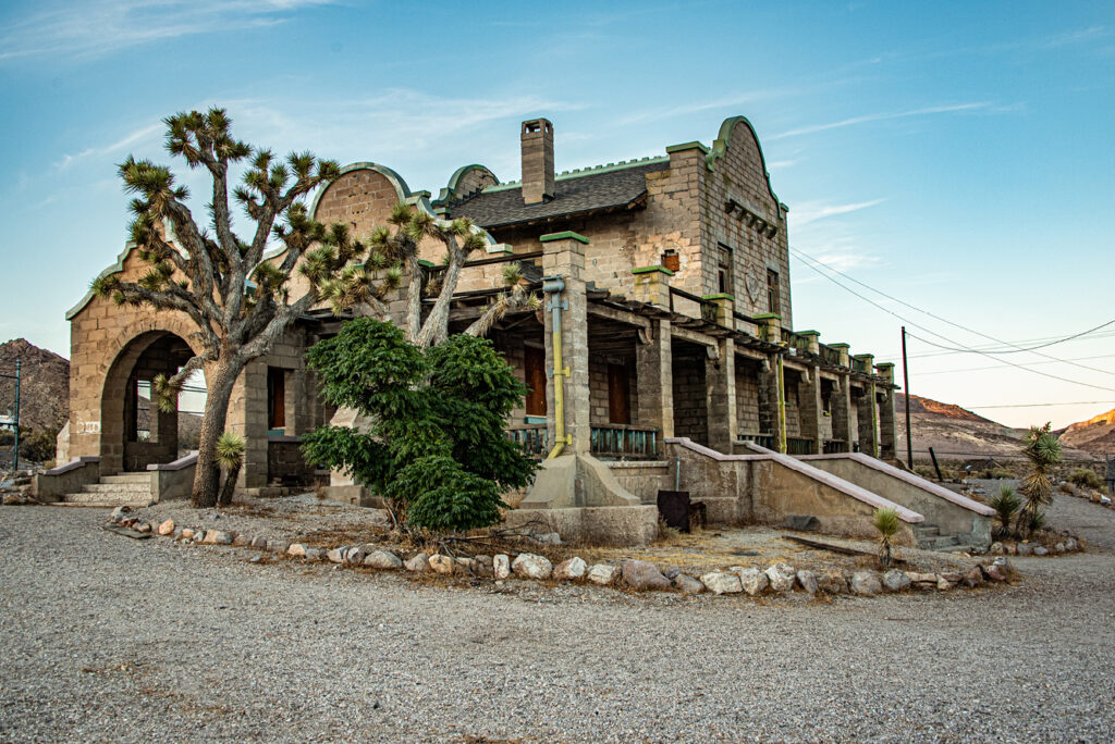
Preservationists saved ghost town Rhyolite’s train station
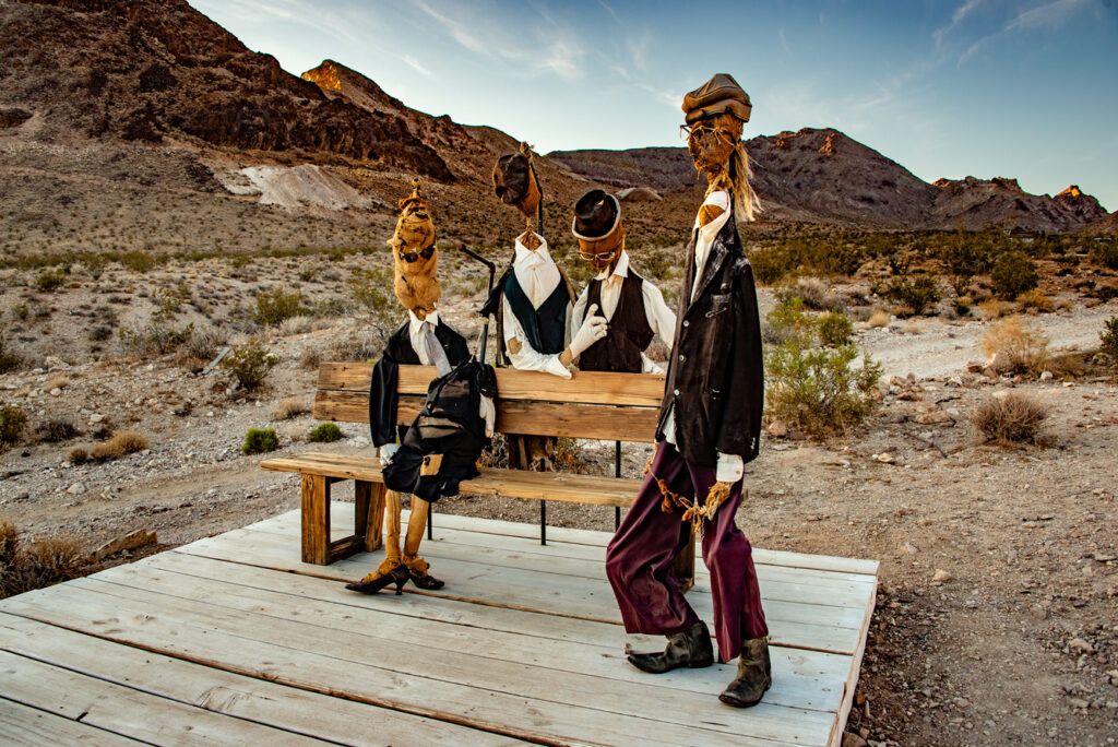
Quirky sculptures waiting for the train are among several Rhyolite art installations
On the return drive to Sin City, we took a detour to Rhyolite, a 1905 mining camp established after discovery of gold nearby, now a ghost town. By 1908, population peaked around 4000; the town was fully equipped with electricity, water, telephones, a railroad, newspaper, hospital, and even an opera house. The mining company quickly exhausted the main veins, investment capital was tight, stocks crashed, and the mines closed.
By 1920, the town emptied out. Easy come, easy go. Rhyolite served as a “motion picture” set for years; now it’s a casual tourist attraction, and most buildings have been torn or fallen down. The intact railroad station and a house made from bottles still stand, along with walls of other buildings and a train car once used to house miners. Located near the town’s entrance, a few quirky modern art installations attracted our attention. Rhyolite was empty the day we visited.
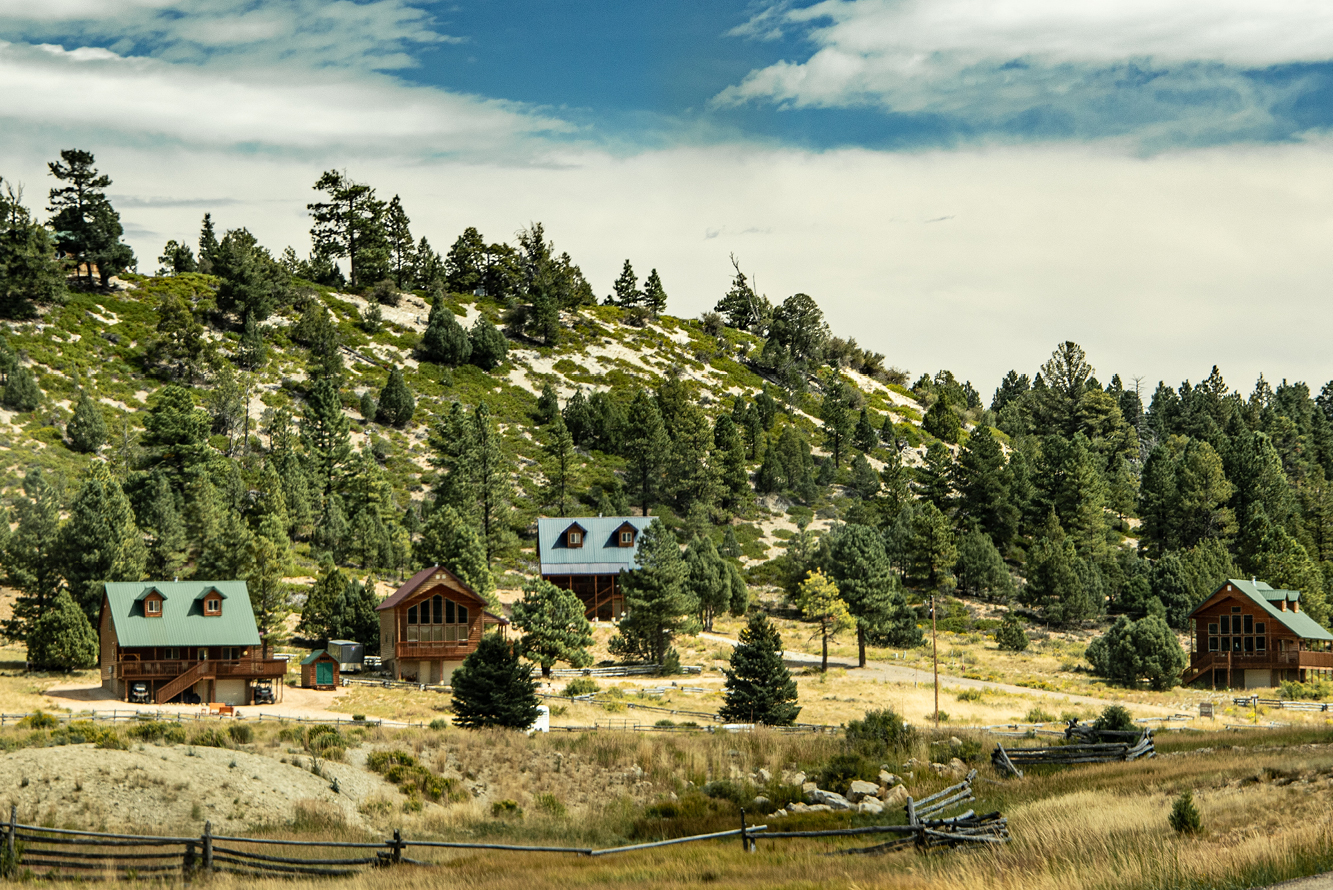
Roadside scenery approaching Bryce Canyon National Park captures a way of life
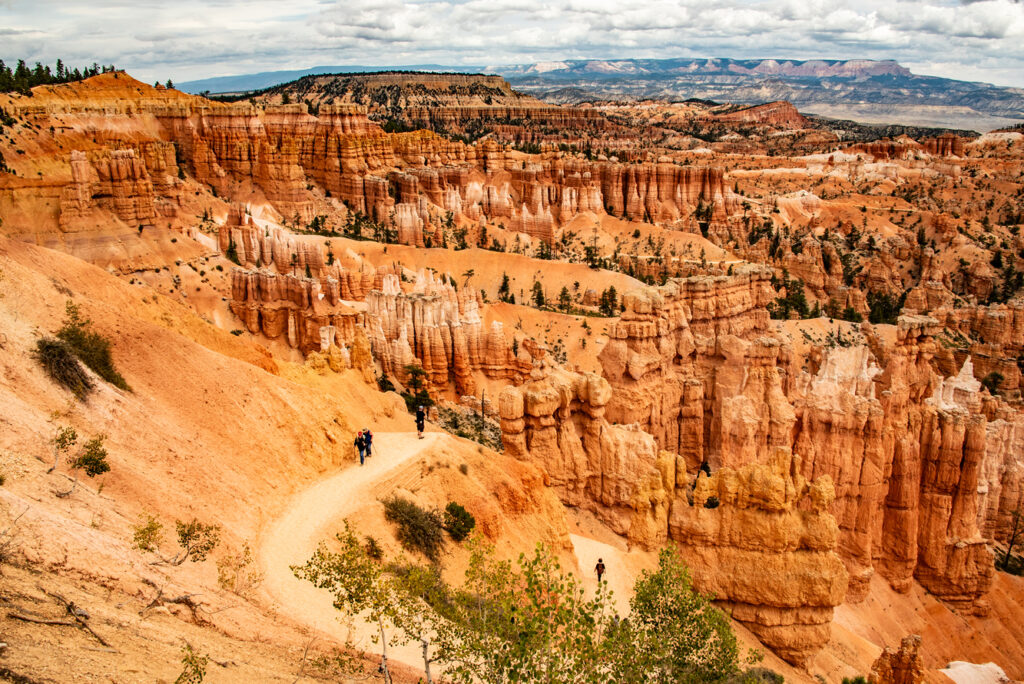
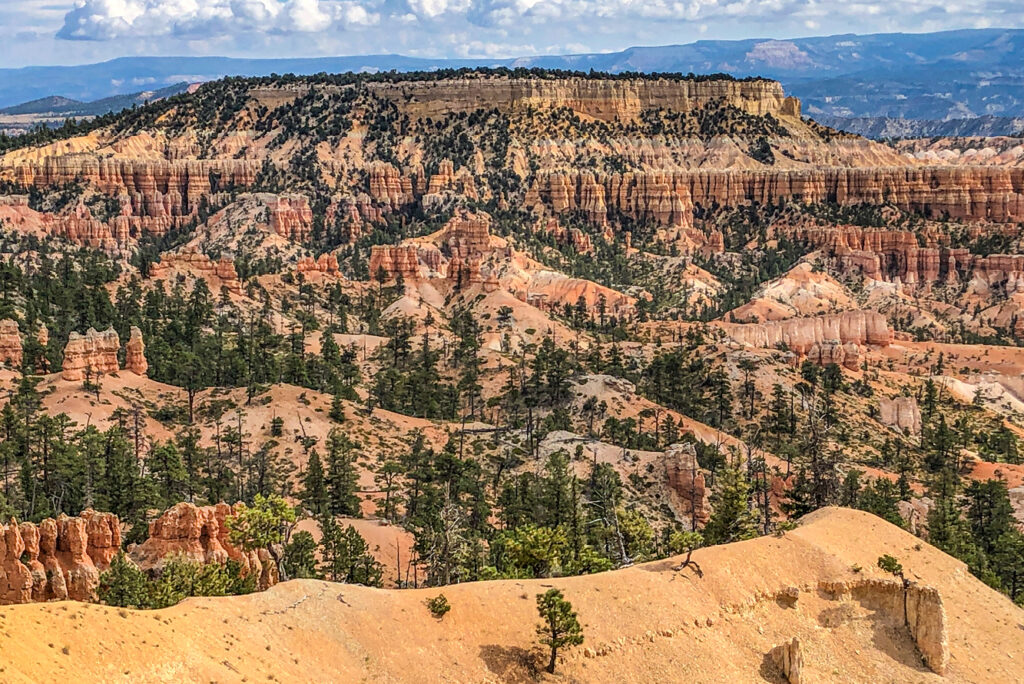
Hoodoos fill Bryce Canyon National Park
Leaving Las Vegas, we headed northeast into Utah for a 3-1/2 hour drive to Bryce Canyon National Park. Along the way, the states’ striking landscapes unfolded––upward thrusting pink rock outcroppings, verdantly lined streams, roadways cut through huge stone formations––all held promises for our adventure.
Past the Visitors Center, three spectacular designated locations along the rim––Sunrise, Sunset, and Inspiration Points––provide excellent vantages for gazing into the majestic amphitheaters of the iconic hoodoos, showing off their red, pink, orange, and white in brilliant sunlight. Weathering and erosion formed these irregular columns of rock that can reach 200 feet tall. Several trails dotted with hikers snake down into the canyon (a misnomer, say geologists, since Bryce Canyon’s origin isn’t the result of an eroding river).
Hiking trails snake down into Bryce’s amphitheaters past hoodoos standing guard
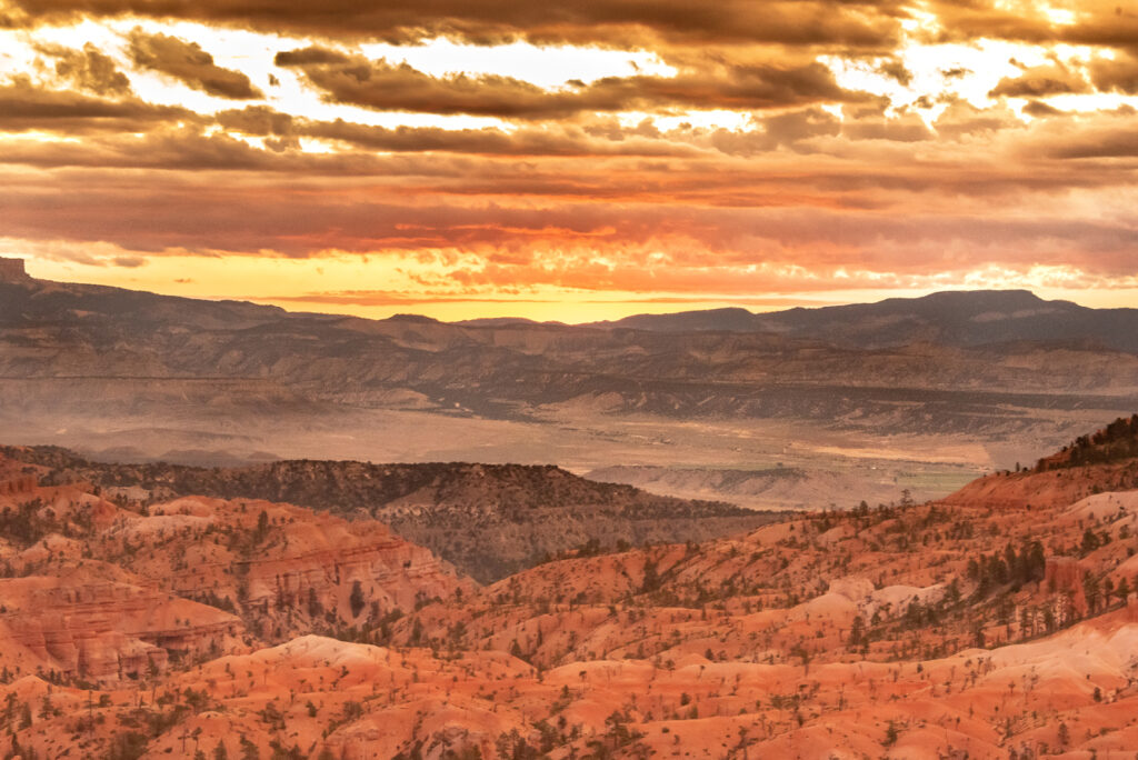
First rays of morning sun illuminate Bryce Canyon
A mesa surrounded by thousands of hoodoos dominates this Bryce Canyon view
Forcing myself out of bed at 4:30 the next morning, I grabbed my camera and headed the 15 miles to Sunrise Point. I found a prime location to impatiently wait for the morning’s herald. I wasn’t alone; many others had the same idea. Nature’s symphony silently blasted my senses, as the sun’s first rays struck the cliffs’ pink walls and illuminated the far reaches of the park.
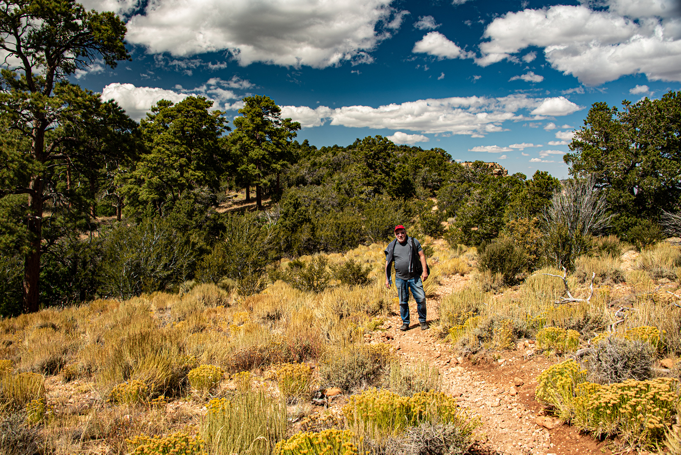
Later that morning, Rick and I rashly decided to hike the two-hour Queen’s Garden trail into the canyon––a lovely descent past hoodoos, through a few arches carved for the trails, down to a serene, grassy valley floor with scrubby trees and scattered wild flowers. We failed to consider the grueling, steep switchback trail to reach the rim far above us and far less scenic than the descent.
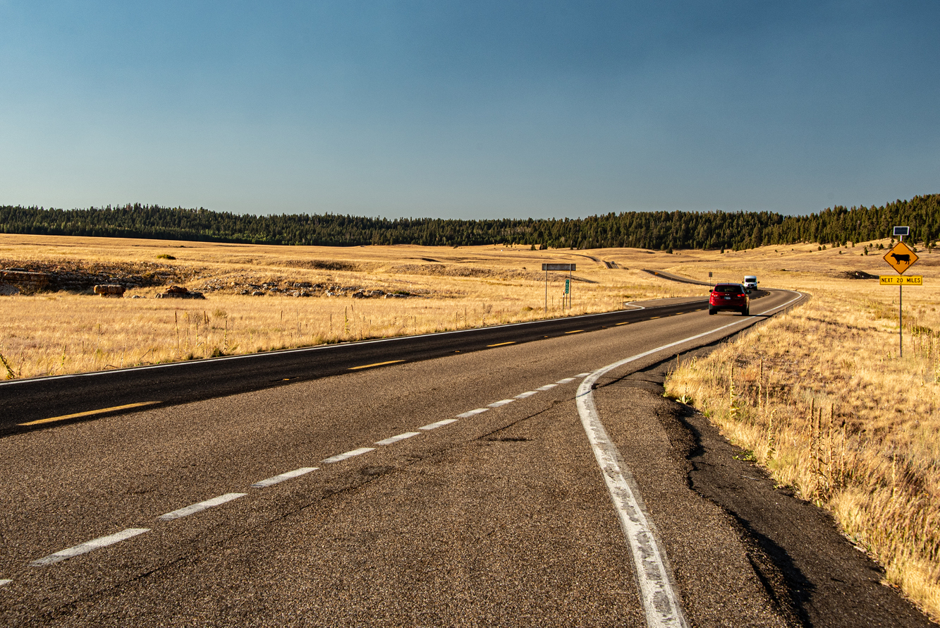
Wheat-colored fields of grasses edged by evergreen forests flank the road to the Grand Canyon’s North Rim
Grand Canyon’s North Rim Elicits Awe
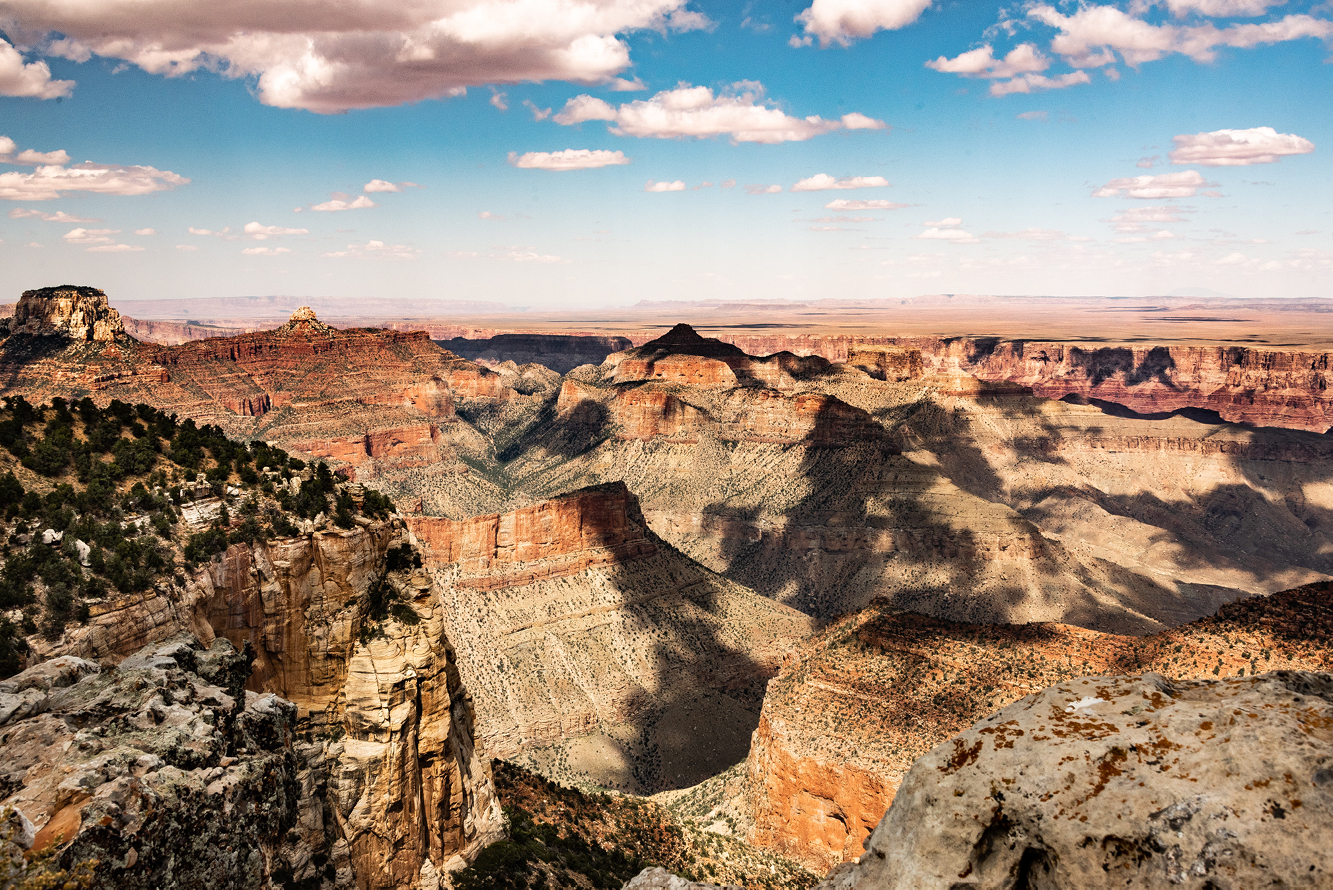
A three-hour drive south into Arizona brought us to the North Rim of the Grand Canyon. The 14-mile road from the national park’s entrance to North Rim Village revealed broad vistas of wheat-colored grasses and low-growing perennials, edged in the distance with the deep green of spruce and fir forests. The North Rim attracts only 10% of Grand Canyon’s visitors; South Rim, its more famous big brother, garners the rest. (A 4-1/2-hour drive separates the two locations.)
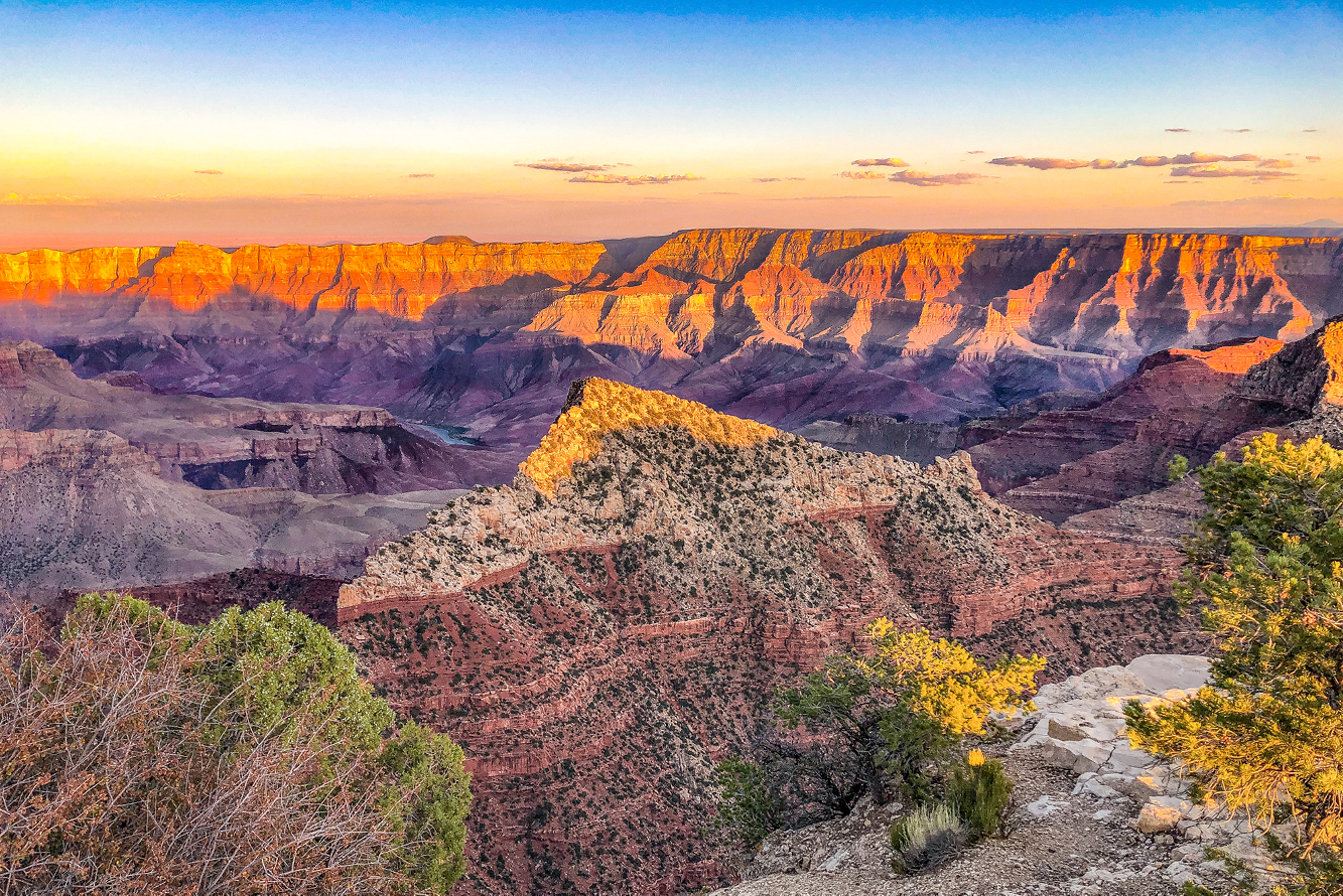
As with Bryce Canyon, Grand Canyon’s audience views nature’s creation from above. Along the Rim’s constructed barrier walls, dozens of fully occupied Adirondack chairs offer relaxing places to view the spectacle. No vacancies. Endless views of the sunken, technicolor mountain range display orange, pink, purple, and yellow igneous and softer sedimentary rock thrusted upward by Earth’s shifting tectonic plates. At the bottom of this extraordinary view, the Colorado River winds in and out of sight, glistening in the sunlight.
Orange and purple mountains fill the Grand Canyon
From a small forest parking lot a few miles from the Village, we took the one-mile Cape Final trail to its terminus, an elevated rock outcropping that required some tricky climbing to join three young men perched on top. Situated a comfortable few feet from a sheer drop with no guardrail, I happily photographed the magnificent scene as large clouds cast moving shadows over jagged peaks.
The two-mile Cape Final trail leads through forests and fields to a rock promontory overlooking the Canyon
View from Cape Final’s promontory reveals the shadows of racing clouds on the Canyon’s outcrops
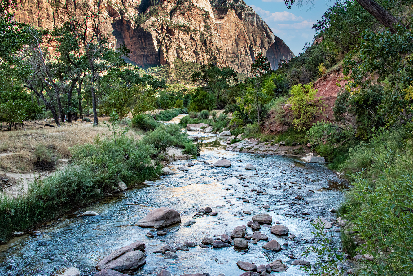
Follow the Virgin River into Zion National Park
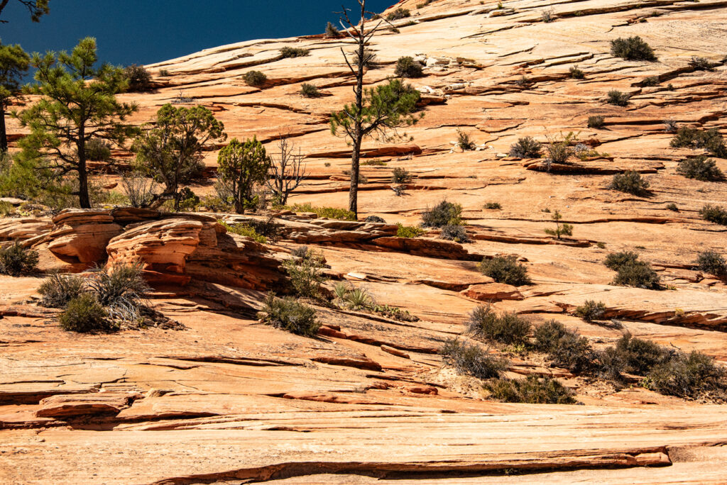
We returned to Utah for our last park visit to enjoy popular Zion National Park, entering the preserve on uber-scenic Route 9, designated as the Zion Park Scenic Byway. The road wandered among barren hills of horizontal slate-like rocks, like a sculpted ten-layer Smith Island Cake. Our full one-day visit barely scratched the surface of this sprawling 230-square-mile park that contains what’s called four life zones––desert, riparian, woodland, and coniferous forest, though many of the opportunities the park offers were beyond our physical capabilities.
A paved trail runs alongside Zion National Park’s Virgin River
Arriving early the next morning at the Zion Canyon Visitor Center, we jumped on the free shuttle for the 45 minute ride to Stop #9, the last stop called Temple at Sinewa. From there, the two-mile flat paved Riverside Walk trail meanders through lush areas of native perennials, shrubs, and trees along the stream, bounded by rock walls.
Horizontal rock slabs comprise these hills along the Zion Park Scenic Byway
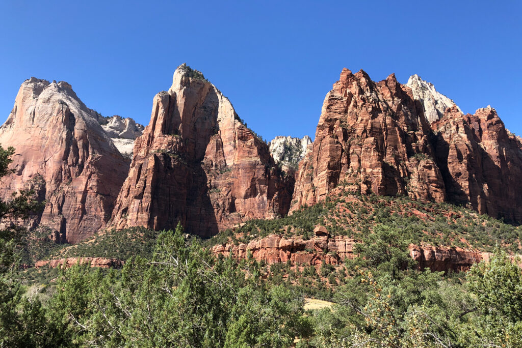
Zion Park’s renowned Court of Patriarchs commands attention
River Walk ends at the Narrows Hike where hikers wade upstream through the shallow Virgin River to continue the trail through stunning rock formations. We lacked appropriate footwear, so we returned to the shuttle, passing too many visitors that unfortunately created a crowded experience. Boarding the bus, we got off at various stops for short hikes to visit Weeping Rock, Angels Landing, and Emerald Pools, all fascinating geological formations, before returning by shuttle to the entrance where we boarded another bus to our lodgings.
The next morning, a 2-1/2-hour drive to Las Vegas’ McCarren International Airport, now renamed Harry Reid Airport, for the flight back to Philadelphia ended the spectacular ten days of exploring this monumental slice of America.
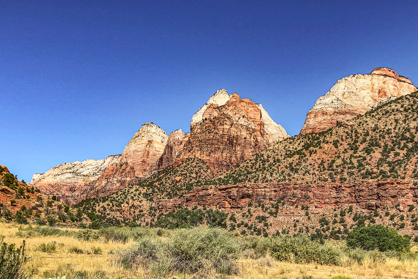
Rock meets meadow in this iconic Zion view
If You Go
Getting There
From Philadelphia International Airport to Harry Reid International Airport: Daily non-stop flights on American, Spirit, and Frontier Airlines
From New York’s JFK Airport to Harry Reid International Airport: Daily non-stop flights on American, Alaska, Jet Blue, Delta, Virgin, Sun County, and Frontier Airlines
Park Entrance Fees Best option to visit all national parks:
Annual pass: America the Beautiful National Parks and Federal Recreational Lands Pass: $80 Regular/$20 Senior/Free for under 16
Daily pass: – Bryce Canyon, Grand Canyon, and Zion National Parks one-day pass: $35 Vehicle and all passengers
– Death Valley: $30 Vehicle and all passengers
Share this journey:
Get the Monthly Newsletter
That's right, just one email per month.
The latest travel stories, photos, and destination inspiration, straight to your inbox.